
Cyclone Narelle Intensifies, Threatens Western Australia’s Coastline with Destructive Winds
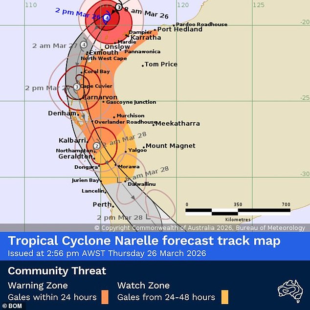
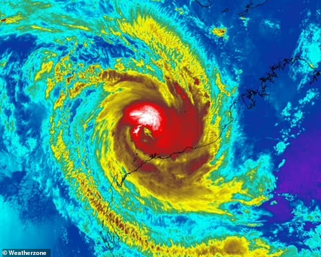
A powerful tropical cyclone, Narelle, has been upgraded to a Category Four system off the northwest coast of Western Australia and is barrelling towards the mainland. The storm is projected to make landfall late on Friday in the Shark Bay region, with the potential to intensify to a Category Five system as it passes by vulnerable coastal communities including Exmouth, Coral Bay, Denham, and Carnarvon.
Authorities are warning of widespread, destructive winds that could inflict significant damage on buildings and homes across the impacted areas if the cyclone reaches its maximum predicted intensity. While the system is expected to be a Category Three storm at landfall, even this level can bring very destructive winds with gusts reaching up to 224 km/h. Category Five storms are exceptionally dangerous, capable of causing widespread devastation with wind gusts exceeding 279 km/h.
Evacuations and Preparations Underway
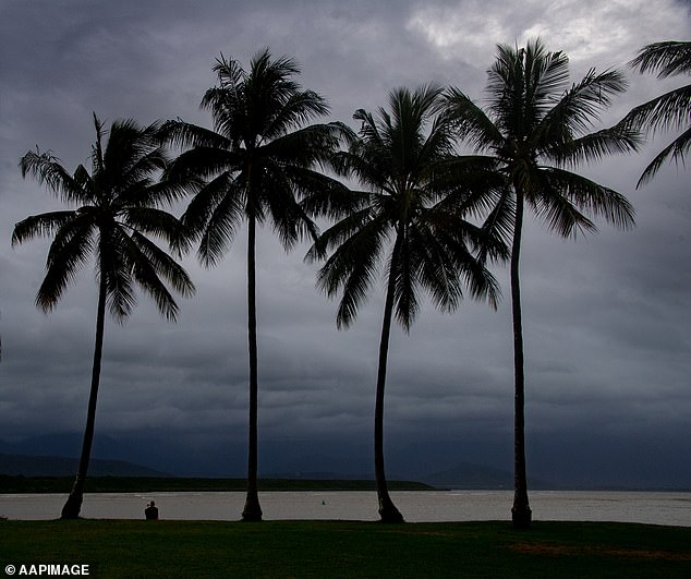
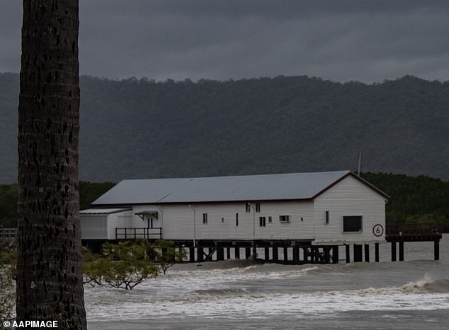
In anticipation of Narelle’s arrival, tourists have been advised to evacuate the region, and major roads have been closed. Evacuation centres have been established to provide shelter for residents. Meteorologists have described Narelle as an unusually large storm, currently packing winds well over 200 km/h. Coastal communities situated between Exmouth and Shark Bay can expect severe wind impacts, along with heavy rainfall.
Potential for Heavy Rainfall and Storm Surges
Forecasters predict that some locations could experience rainfall exceeding 200mm, leading to flash flooding. Significant storm surges are also a considerable threat. In the small holiday town of Denham, located on the Peron Peninsula approximately 830 km north of Perth, volunteers have been actively sandbagging in preparation for a potential tidal surge. Residents are bracing for the worst-case scenario while hoping for a less severe outcome.
In Exmouth, a town with a population of around 3,000, residents have been diligently securing their properties, with many having experienced the devastating impact of a Category Five cyclone in the past. Tropical Cyclone Vance, which struck the town on March 22, 1999, serves as a stark reminder of the destructive power of such storms. This history makes many residents particularly wary of Narelle’s approach.
Narelle’s Journey Across Northern Australia
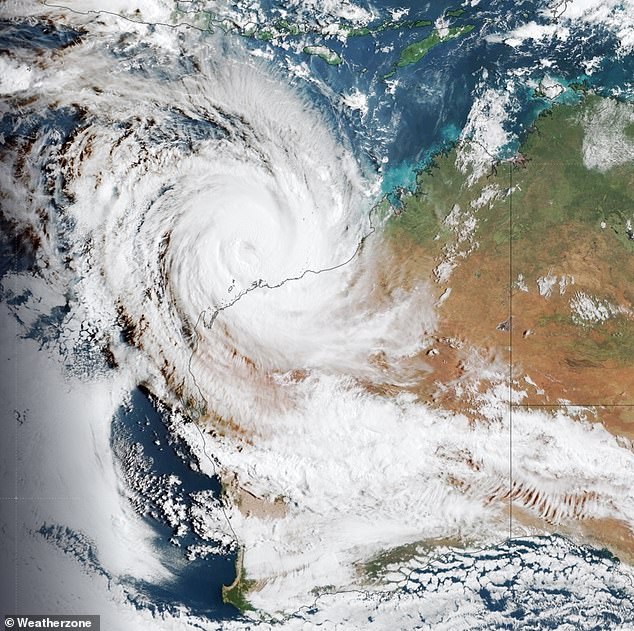
Narelle’s extensive journey began when it first made landfall in Queensland as a Category Four system, crossing the Cape York Peninsula. It subsequently moved over the Northern Territory as a Category Three storm by Sunday, leaving a trail of power outages and flooding, and forcing hundreds of people to evacuate. After initially crossing northern Western Australia as a tropical low on Monday, Narelle gained strength in the Indian Ocean, tracking southwest along the Pilbara coastline.
Currently, the system is generating gusts of up to 230 km/h and is situated approximately 365 km northeast of Exmouth. Following its projected landfall on the coast, the system is expected to move southeast. It is forecast to pass east of Perth as a tropical low on Saturday, bringing showers and thunderstorms, before heading into the Southern Ocean on Sunday.
Impact on the Northern Territory
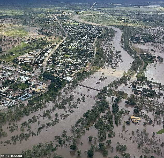
The Northern Territory has already felt the effects of Narelle. The town of Katherine experienced inundation for the second time in a month due to heavy rainfall. Emergency shelters have been prepared for evacuees, and a portable field hospital has been set up after the town’s main hospital was forced to close. The Katherine River was anticipated to peak just above the major flood level of 17.5 metres at the town bridge on Thursday, highlighting the widespread impact of this formidable cyclone.


